
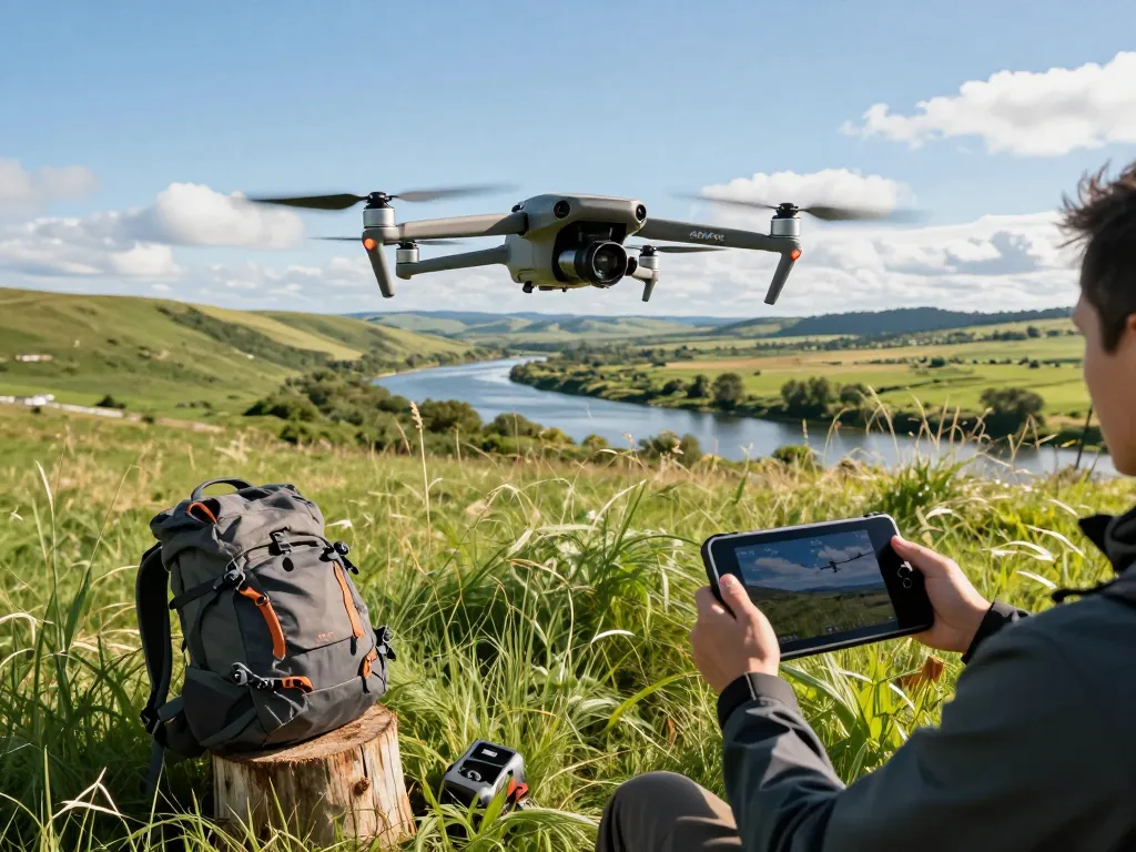
Understanding the Mavic 3E’s Specifications
The mavic 3e is DJI’s latest addition to the Mavic series, perfectly balancing advanced technology with user-friendly features. This drone is designed for industrial applications, offering capabilities that cater to mapping, surveying, and emergency response scenarios. With an emphasis on versatility and outstanding performance, it is quickly becoming a go-to choice for professionals in various fields.
Key Features of the Mavic 3E
The Mavic 3E is packed with features that enhance its usability and functionality:
- 56× Hybrid Zoom Camera: Enables detailed inspections from a distance without compromising image quality.
- 4/3 CMOS Sensor: Provides exceptional imaging capabilities, allowing for high-resolution captures even in low light environments.
- RTK Module: Facilitates centimeter-level positioning accuracy, which is vital for mapping and surveying tasks.
- Mechanical Shutter: Eliminates rolling shutter distortion, crucial for dynamic scenes and fast-moving subjects.
Technical Specifications Explained
With its compact design, the Mavic 3E measures approximately 347.5 x 290.5 x 107.7 mm when folded and has a maximum takeoff weight of 895 grams. It boasts a flight time of up to 46 minutes, which is impressive and allows operators to cover significant distances without interruption. Furthermore, its operational range extends to 15 kilometers, ensuring extensive coverage for various projects.
Advanced Camera Capabilities
The camera system on the Mavic 3E includes a wide-angle lens with a 20MP resolution, capturing stunning aerial images and videos. This drone is also compatible with thermal imaging, making it an excellent tool for search and rescue operations and wildlife monitoring. Its sophisticated imaging technology ensures that every detail is captured, resulting in professional-grade outputs.
Practical Applications of the Mavic 3E
With its cutting-edge features, the Mavic 3E has reshaped how industries utilize drones for practical applications. It excels in several fields:
Mapping and Surveying Efficiency
The Mavic 3E significantly enhances mapping and surveying processes. Its RTK capability allows for precision mapping, reducing the time and cost associated with traditional surveying methods. Users can generate 2D and 3D maps quickly, supporting industries such as construction, agriculture, and urban planning.
Thermal Imaging Usage
In addition to its visual imaging capabilities, the thermal version of the Mavic 3E is vital for several applications, including:
- Energy Audits: Identifying heat loss in buildings.
- Search and Rescue: Locating missing persons in challenging terrains.
- Firefighting: Spotting hotspots in wildfire management.
Creative Aerial Photography Techniques
For photographers and videographers, the Mavic 3E opens up creative possibilities. Its ability to shoot in RAW format and the inclusion of advanced filters allow for stunning captures that can be enhanced in post-production. Whether it’s landscape photography or dynamic sports shots, the Mavic 3E delivers exceptional results.
Setting Up Your Mavic 3E for Success
To maximize the capabilities of your Mavic 3E, proper setup is crucial. Here’s how to get started:
Unboxing and Initial Setup
Upon unboxing your Mavic 3E, ensure that all components are accounted for, including extra propellers, the remote controller, and the charging kit. Following the manufacturer’s setup guide, install the DJI GO 4 app to facilitate a seamless connection between the drone and your smartphone.
Calibration and Pre-flight Checks
Calibrating the drone’s compass and IMU is essential for accurate flight operations. Always perform a pre-flight checklist that includes inspecting the drone’s condition, checking battery levels, and ensuring firmware is updated.
Optimal Flight Conditions and Safety Tips
Flying in optimal conditions—clear skies and low wind—is essential for achieving the best performance from the Mavic 3E. Always adhere to local regulations, maintain visual line of sight, and ensure you are aware of your surroundings to promote safe flying practices.
Real-World Case Studies
Understanding the practical impact of the Mavic 3E can be enhanced through real-world applications:
Mapping Success in Construction Projects
In construction, the Mavic 3E streamlines project management by providing up-to-date aerial views and accurate land measurements. This data has been instrumental in keeping projects within budget and time constraints.
Environmental Monitoring Applications
Environmental agencies utilize the Mavic 3E for monitoring wildlife, tracking deforestation, and assessing natural disaster impacts. Its high-resolution imagery coupled with thermal capabilities allows for comprehensive assessments that guide conservation efforts.
Innovative Use Cases in Emergency Services
Emergency responders leverage the Mavic 3E during crisis situations. Drones equipped with thermal imaging can quickly locate individuals in various environments, while the high-resolution camera aids in assessing damage from natural disasters.
Future Trends and Developments for Aerial Drones
The landscape for drone technology continues to evolve, influencing how the Mavic 3E and its successors will be utilized.
Emerging Technologies Impacting Drones in 2026
As of 2026, advancements in AI and machine learning are set to enhance aerial drones, making them more autonomous and capable of complex decision-making processes. This will further expand their applications across multiple industries.
Regulatory Changes and Industry Standards
With the increasing use of drones, regulatory frameworks are adapting. Future guidelines will likely focus on ensuring safety, privacy, and the environmental impact of drone operations, which will require operators to stay informed of the latest standards.
The Future of Drone Photography and Videography
In the realm of photography and videography, emerging trends suggest an increase in the integration of drones with virtual reality and augmented reality applications, creating immersive experiences that redefine how audiences interact with visual content.
What are the key features of the Mavic 3E?
The Mavic 3E includes advanced imaging capabilities, precise RTK technology, and extended flight times, positioning it as a leader in the commercial drone market.
How is the Mavic 3E used in emergency services?
Emergency services utilize the Mavic 3E for search and rescue operations, real-time situational assessments, and damage evaluations, significantly improving response times and effectiveness.
What makes the Mavic 3E a suitable choice for industrial applications?
Its accuracy, outstanding imaging systems, and multifunctional capabilities make the Mavic 3E an ideal choice for various industrial applications, including mapping, surveying, and inspection.
Can the Mavic 3E be flown in adverse weather conditions?
While the Mavic 3E is designed for durability, it is not recommended to operate in heavy rain or high winds as such conditions can impair performance and safety.
How do I maintain my Mavic 3E for optimal performance?
Regular maintenance such as firmware updates, battery care, and thorough cleaning after flights will ensure your Mavic 3E operates at its best. Inspecting physical components for wear and tear is also essential in maintaining safe and effective operations.